WINTER WEATHER ACTIVATION FEB. 25, 2015

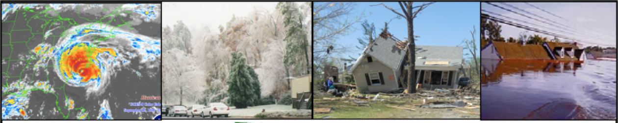
Central Carolina SKYWARN  (CCS) will activate for this event per the direction of the Raleigh National Weather service.  We will activate on the 146.88 when the precipitation begins in the CCS area, and then start formal nets at the top of each hour tonight until 12:00 midnight. We will begin again at 06:00 AM Thursday and continue until the NWS directs us to stand down. We will monitor in between nets for any changeovers in precipitation.

Spotter reports should include the following information:

  • Name, call sign, and spotter number if any
  • Location and nearest cross street
  • Precipitation type (rain, freezing rain, sleet, or snow)
  • Intensity of precipitation (light, moderate or heavy)
  • Changeovers in precipitation and time
  • Accumulation of ice accretion
  • Impacts such as road conditions (particularly any roads that are impassable or closed), sustained power outages (not just blinking), and downed limbs/trees from ice.

Our backup repeater will be the 147.105 repeater with a tone of 82.5 Hz located in Broadway, NC.

Folks may make reports via the SKYWARN net, or post here on the Central Carolina SKYWARN Facebook page.

The SKYWARN Net may also be monitored via live-streamed audio at www.broadcastify.com .

We appreciate your reports. Stay safe!

Winter Weather Activation FEB. 24, 2015

Central Carolina SKYWARN will activate for this event per the direction of the Raleigh National Weather service.  We will activate on the 146.88 beginning at 07:00 and do a winter weather net at the top of each hour until midnight.  We will do so for the duration of the event or until the NWS directs us to stand down.   We will monitor in between nets for any changeovers in precipitation.

Spotter reports should include the following information:

  • Name, call sign, and spotter number if any
  • Location
  • Precipitation type (rain, freezing rain, sleet, or snow)
  • Intensity of precipitation (light, moderate or heavy)
  • Changeovers in precipitation and time
  • Accumulation or ice accretion
  • Impacts such as road conditions (particularly any roads that are impassable or closed), sustained power outages (not just blinking), and downed limbs/trees from ice.

Our backup repeater will be the 147.105 repeater with a tone of 82.5 Hz located in Broadway, NC.

Folks may make reports via the SKYWARN net or on the Central Carolina SKYWARN Facebook page.

The SKYWARN Net may also be monitored via live-streamed audio at www.broadcastify.com.

Hope to hear your personal spotter report later today!

ANNUAL SPOTTER TRAINING VIA THE NET FEB. 24 & MAR. 3

SKYWARN Spotter Training will be offered on the CCS Information Net on Feb. 24 & March 3 at 9:15 PM on the 146.88 repeater as part of the Severe Weather Preparedness Week.

This training may used to earn initial spotter certification or renew certification which is required every three years.

Part 1 of Basic Training will be Feb.24 ; Part 2, March 3. The instructor will be Nick Petro WX3H, Warning Coordination Meteorologist with the Raleigh National Weather Service.

To fully benefit from this training and to receive a spotter number, you must:

A. download the training presentation before each net from www.centralcarolinaskywarn.net  (It will be included with the Weekly Weather Impact Briefing.  Click on the Weekly Weather Impact Briefing on the top menu to download.)
B. listen and check in at the end of both nets, and
C. email CCS Emergency Coordinator Virginia Enzor at nc4va@nc.rr.com with your name, call sign (if licensed), spotter number (if already assigned) and email address.  The NWS will then contact you about completing the spotter certification process.

Scanner listeners and listeners receiving live streaming audio on the internet at www.broadcastify.com may also participate by downloading the presentations and emailing Virginia Enzor at nc4va@nc.rr.com immediately after both nets. Again, be sure to your name, call sign (if licensed), spotter number (if already assigned) and email address.

WINTER WEATHER ACTIVATION FEB. 16-17, 2015

Central Carolina SKYWARN will activate for this event per the direction of the Raleigh National Weather service.  We will activate on the 146.88 repeater late in the afternoon when the precip arrives and do a winter weather net at the top of each hour until midnight.  We will resume Tuesday morning at 6am for the duration of the event or until the NWS directs us to stand down.   We will monitor in between nets for any changeovers in precipitation.

Spotter reports should include the following information:

  • Name, call sign, and spotter number if any
  • Location
  • Precipitation type (rain, freezing rain, sleet, or snow)
  • Intensity of precipitation (light, moderate or heavy)
  • Changeovers in precipitation and time
  • Accumulation or ice accretion
  • Impacts such as road conditions (particularly any roads that are impassable or closed), sustained power outages (not just blinking), and downed limbs/trees from ice.

Our backup repeater will be the 147.105 repeater with a tone of 82.5 Hz located in Broadway, NC.

Folks may make reports via the SKYWARN net or on the Central Carolina SKYWARN Facebook page.

The SKYWARN Net may also be monitored via live-streamed audio at www.broadcastify.com.

Hope to hear your personal spotter report later today!

TORNADO FORECASTING WORKSHOP

The University of Oklahoma Student Chapter of the AMS (OUSCAMS) is presenting a Tornado Forecasting Workshop with Storm Prediction Center’s Rich Thompson. The series starts this Tuesday (Feb. 3), and runs from 7:30 – 9:00 p.m. CT. They will broadcast the workshops live on YouTube and record them for later viewing on the Chapter’s YouTube site. A flyer and current schedule of events is available below. Visit the OUSCAMS social media sites for more information.  Other scheduled presentation include:

February 10 – Severe storm ingredients (low-level moisture and lapse rates)

February 17 – Severe storm ingredients (vertical shear and lift)

March 3 – Supercell and tornado conceptual models (plus composite parameters)

March 10 – Tornado patterns (synoptic and mesoscale)

March 24 – Convective mode forecasting (squall lines vs. discrete cells)

April 7 – Tornado parameter climatology (spatial and temporal distributions of CAPE and shear)

April 14 – Numerical models and statistical techniques (convective schemes and post processing)

April 21 – Real-time forecasting exercise